about the Purple Haze site
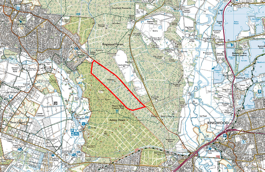
The proposed Purple Haze site is located south east of the town of Verwood, south of the B3081 Verwood Road. The other main settlements in the area are Ringwood to the south east and Ashley Heath to the south of the site.
The site covers approximately 70 hectares and is utilised as a commercial coniferous forest managed by Forestry England, who will over time fell the existing trees and replant those areas.
The site is adjacent to, but does not form part of, Moors Valley Country Park. It is informally used by walkers and horse riders, as well as being included on some cycle and walking routes promoted by the Park.
Ground levels vary across the site from 26mAOD at the northern end, to 37m at the southern boundary, peaking at 50m in the centre.